
(Special Playground and Urban Landscape)
The color that invades the city refers to a “tactical” vision of urban planning, waiting for a real overall “strategy”. The example of Milan.
Tactical Urbanism: Milan from open squares to open streets
Also published in: Tsport 341
Milano, via Venini (foto Comune di Milano)
Go to the other articles in the Playground and Urban Landscape Special:
- Isernia, the Urban Park of the railway station
- Muggiò (Monza), the Joy and Kindness Garden
- Street art colours playgrounds
The “tactical urbanism”
The definition of “tactical urbanism” was introduced in 2015 within the exhibition “Uneven Growth: Tactical Urbanisms for Expanding Megacities” curated for MoMa by Pedro Gadanho. It consists in the adoption of localized interventions, carried out with light means and a reduced bureaucratic process, but with a strong visual impact, with the aim of triggering, as a whole, in a short time, an improvement of urban livability starting from the participation of citizens.

San Cristòbal de La Laguna nell’isola di Tenerife, Canarie (foto Mapei). 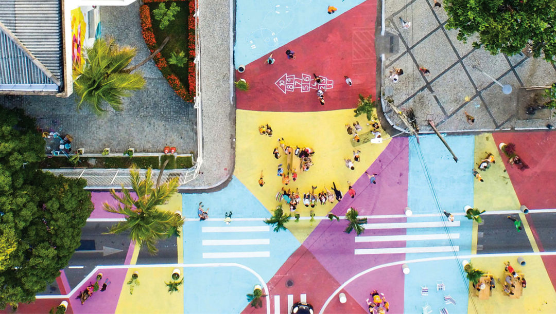
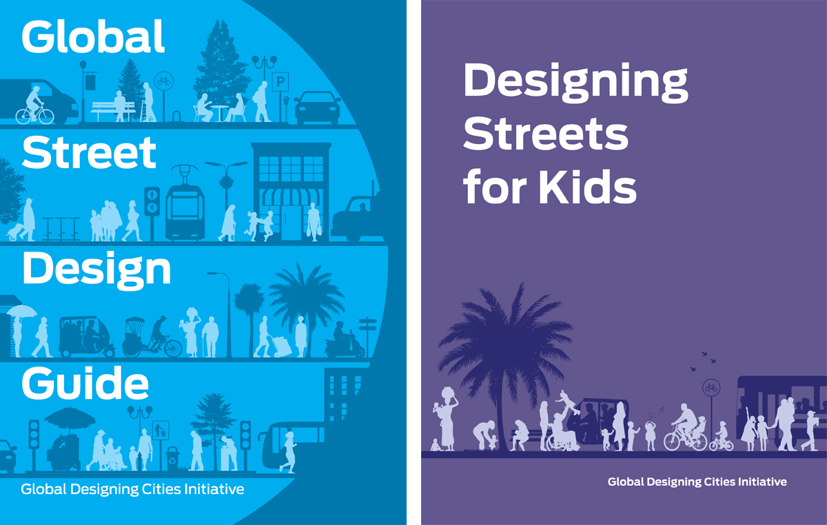
Una immagine tratta dalla guida “Designing Streets for Kids”, NACTO 2020 (foto di Victor Macedo).

Global Designing Cities Initiative (GDCI) is a program of the National Association of City Transportation Officials (NACTO), a nonprofit organization based in New York City, a program comprised of a team of designers, urbanists, and planners that focuses on the critical role of streets within urban environments around the world, committing to selecting and sharing “best practices” in the field.
In 2016, NACTO and GDCI published the Global Street Design Guide, based on documents such as New York City’s Street Design Manual and the Urban Street Design and Bikeway Design Guides produced in previous years. Funded by Bloomberg Philanthropies, the Global Street Design aims to empower city governments to better develop the potential of their networks of public spaces. By treating streets as spaces that integrate different functions and uses, the guide aims to help cities transform streets into safe, accessible, and economically sustainable places.

Le copertine di due manuali pubblicati da NACTO e GDCI.
Open squares
In September 2018, the City of Milan launched the “Piazze Aperte” program, developed in collaboration with Bloomberg Associates, NACTO and GDCI.
Key method of the program is the use of tactical urbanism “to generate public spaces in place of redundant streets or intersections through the implementation of light, fast and inexpensive interventions in Experimental Way.”
The temporary nature of the interventions makes it possible to act quickly and test solutions in a reversible manner, before investing time and resources in a permanent structural arrangement, anticipating the effects with immediate benefits and supporting the decision-making process towards a permanent solution (this is how the program presentation document expresses it).
The following year, the Municipality invited, with a public notice, all citizens to propose interventions on public spaces, applying the principles of social nature inherent in the original concept of tactical urbanism, with the involvement of the inhabitants in the processes of urban regeneration on a neighborhood scale.
The result of the first experiments carried out leads – at least in the first times when the colors on the asphalt are bright and brilliant – to a remarkable aesthetic effect in terms of street furniture, while greater problems involve the management of vehicular traffic, which must be carefully studied before the intervention where crucial space is taken away from the road system.
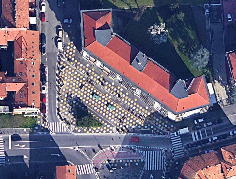
Piazza Angilberto II (Google Earth). 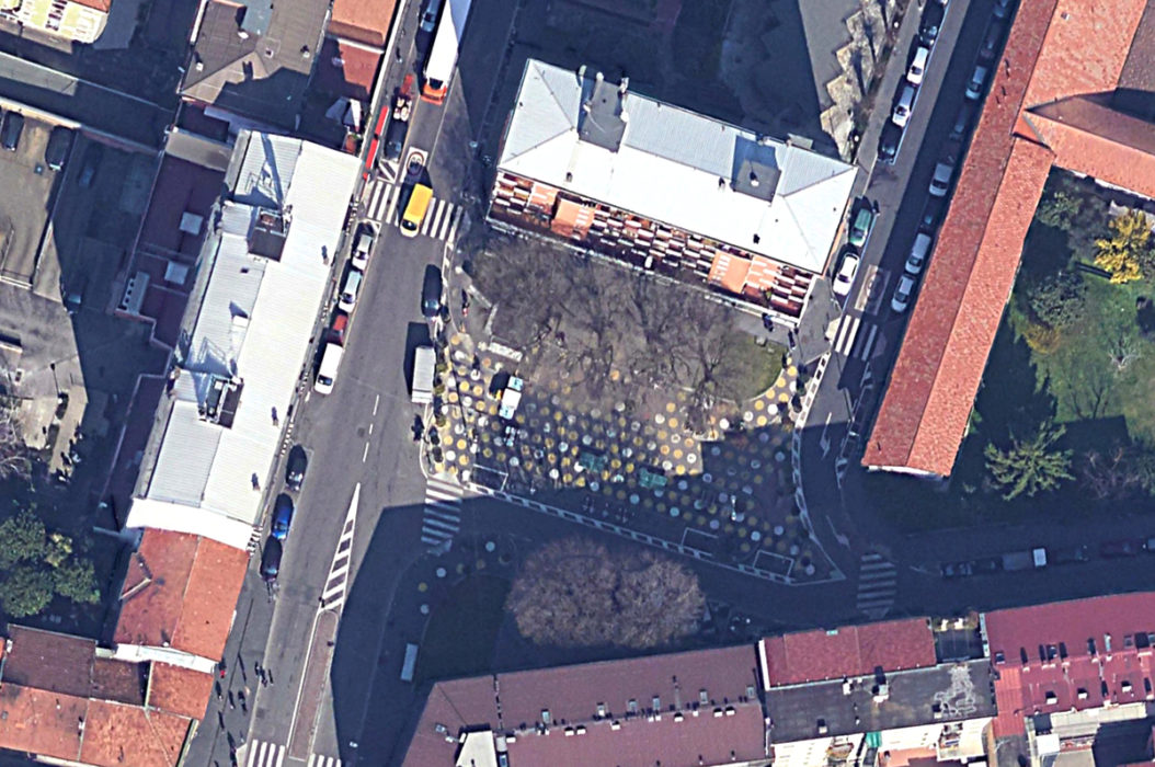
Piazza Dergano (Google Earth).
The interventions carried out
– Angilberto II Square
Among the very first interventions implemented, Piazza Angilberto was pedestrianized in the area between Via Bessarione and Via Comacchio. The paving has become more colorful, a new BikeMi station has been installed and racks for private bicycles, some seats, as well as plants, flower boxes and ping pong tables have been laid. The carriageway has been narrowed on the part of the square adjacent to Via Bessarione and a new cycle path has been created on Via Comacchio, providing a connection with Piazza Ferrara. In order to cope with the increase in vehicular traffic in the surrounding areas, the timing of the traffic lights has been adjusted.
– Dergano Square
In Dergano square, the sidewalk on the north side of the square has been connected to the new pedestrian space obtained by recovering square meters of street space (previously occupied by parked cars). The space has been redesigned to include seating, children’s play areas, racks for private and shared bicycles (BikeMi). The intervention, similar to that of Angilberto II square, after an experiment of twelve months and a positive comparison with the inhabitants of the neighborhood, is intended to move to the final arrangement, integrating it with structural works and expanding the redevelopment to the neighboring streets, where the paving will be redone to flush in continuity with the square.
Piazza Dergano (foto Comune di Milano).

– Porta Genova
In response to the need for municipalities to reorganize public and private spaces of the city to counter the spread of Covid-19, the project “StrategieGreen 2020” takes the opportunity to rethink urban spaces in the short term with effective solutions and immediate implementation, espousing the logic of tactical urban planning.
The StrategieGreen 2020 Project proposes a framework of interventions of urban design and creation of green areas, to be implemented through an open strategic partnership promoter and a management model of interventions at no cost for the Administration or co-financing through sponsors in different ways..
For the intervention in Porta Genova a pact of collaboration with the Municipal Administration has been signed by Assoverde (leader), Nespoli Vivai and Zack Goodman.
Among the companies that collaborated, Mapei provided the materials for the repainting of the colored stripes on the asphalt and stone surface, made with Mapecoat TNS Extreme in combination with an epoxy primer for setting on the surfaces and a polyurethane protective agent to complete, from the same Mapecoat line.
Piazzale di Porta Genova (foto Mapei).

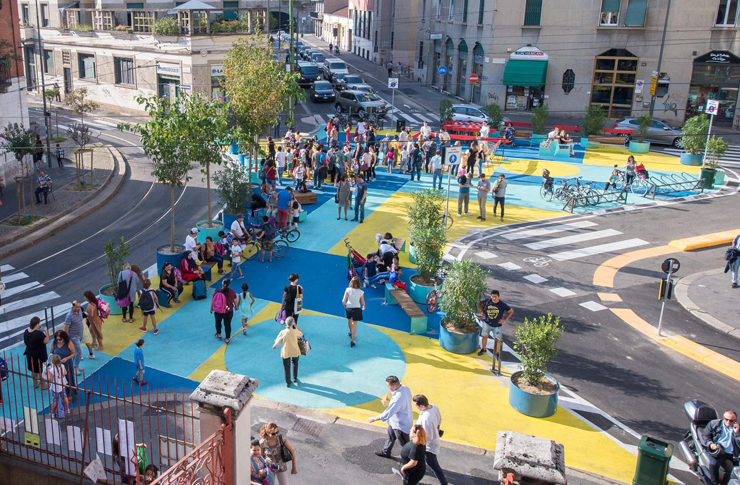
– Via Venini
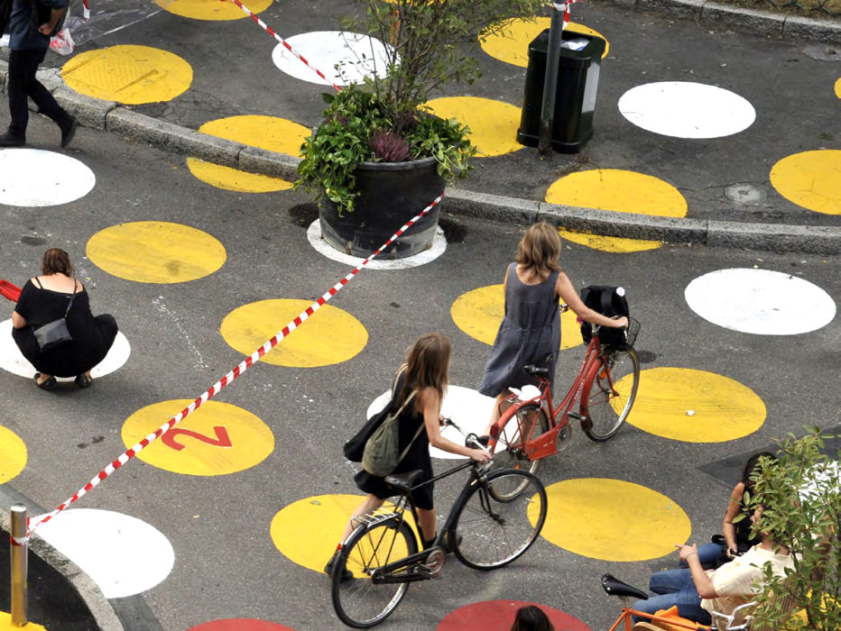
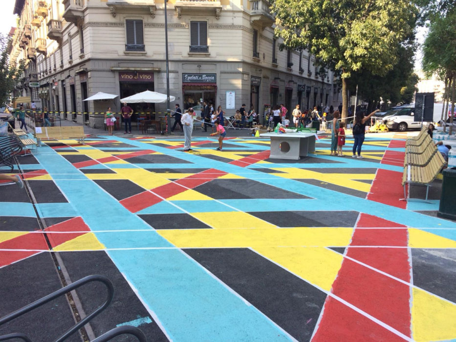
The new ‘open square’ in the district of NoLo (North Loreto), between via Spoleto, via Venini and via Martiri Oscuri, consists of a multicolored pedestrian space in front of the elementary school Cerisola: the paving is colored in shades of yellow, blue and blue, and are placed flower boxes, racks, benches and ping pong tables (see the photo at the top of this page). The furniture was provided by Vestre, an Oslo-based company.
The new space, which accepts the requests of the families of the Cerisola school, has the function of making safer the entrance and exit from school for children, and to create a new place of social interaction for the citizens of the neighborhood.
The integral rethinking had the objective of slowing down and diluting the crossing traffic, through unique senses, bicycle lanes, pedestrian crossings: a revolution that has aroused the predictable negative reaction from traders and motorists.
– Via Pacini
A further intervention of Tactical Urbanism has been realized in via Pacini (near one of the exits of the MM1 Piola station).
This is the requalification of a section of the street carried out with paints and brushes by the volunteers of Retake Milano on the basis of a “Collaboration Pact” between the Municipality and the citizens, after the municipal workers had, in the previous months, laid new benches and bicycle racks.
Via Pacini (foto BG/Sport&Impianti).
For a length of about fifty meters, the central reservation (in part already equipped with benches and in part cleared of parked cars) has been colored with yellow and green backgrounds, and enriched with a few more benches, two picnic tables, bike racks.
Here it was Apicultura Studio, a group of young architects and engineers based in Milan but scattered in different Italian regions, that took care of the tactical urban planning.
– Piazzale Bacone
Finally, work has just been completed to redesign Piazzale Bacone and nearby Via Spontini, Via Monteverdi, Via Matteucci and Via Paracelso, to the northeast of the city.
The first phase includes the modification of the signage and the road system, with the establishment of unique senses and changes in the parking areas, which will allow the widening of sidewalks in Piazzale Bacone and at intersections for greater road safety of crossings and better accessibility to schools, increase of pedestrian space, establishment of the zone 30 and reconnection of bike paths. Elements of furniture were then laid (14 benches, a ping-pong table, three picnic tables, eight bicycle racks and 24 potted plants) and, with the active participation of citizens, the paving of the area was colored.
Piazzale Bacone (foto Comune di Milano).

The second part of the operation, that of the structural redevelopment that also includes the connection between Corso Buenos Aires and Piazza Lima to Piazza Piola, the reorganization of the road system and the complete bicycle connection, as well as the removal of the tram tracks no longer in use, will be launched during 2022.
From open squares to open streets
It took the eruption of the pandemic emergency in 2020 for the “tactic” of Open Squares to converge with the predictions of the Urban Plan for Sustainable Mobility (PUMS), also approved in late 2018.
The sudden lockdown that has blocked almost all the activities, and the forced reduction in the use of public transport to avoid gatherings, has led the City to accelerate what has already been outlined in perspective to orient the city towards a more sustainable mobility.
The adaptation strategy “Milano 2020 – Strade Aperte” proposed to “rethink the schedules and rhythms of the city to reduce and distribute the demand for travel throughout the day and aims to improve and diversify even more the mobility offer, implementing and exploiting the full potential allowed for public transport and rapid mass transit infrastructure such as subways and metros, in parallel to promote the use of sustainable and active mobility and sharing“.
In coherence with the PUMS, an “extraordinary plan for new emergency bicycle routes” has been launched: to promote an effective active mobility, the realization of a system of bicycle routes (load-bearing frame) has been accelerated, both radial for the connection with the districts of the city more distant from the center and with the municipalities of the metropolitan city, and annular and transversal to promote systematic movements between the different urban centers. The main routes are integrated with interventions of widespread cycling and moderate traffic areas (30 zones) for a safe and livable mobility of the neighborhood.
Corso Buenos Aires (foto BG/Sport&Impianti). 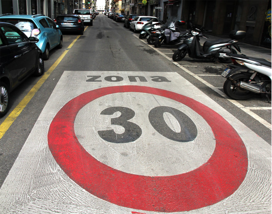
Via Lazzaro Palazzi (foto BG/Sport&Impianti).


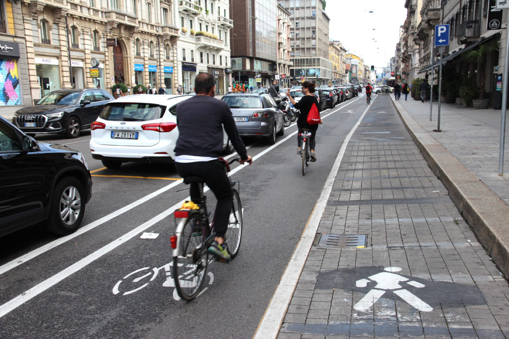
In this emergency phase, the interventions for the creation of new bike lanes were carried out with the same approach of the “Open Squares”: that is, with horizontal signage interventions, quick and reversible.
These are effectively “emergency” solutions, given that a complete and effective plan would have to reset the entire urban road system. The new bike lanes designed on asphalt are not always safe and efficient, as the most famous experiment has shown, the one that through Corso Buenos Ayres and Viale Monza reaches the borders of Sesto San Giovanni.
Via Carducci (Google Street View). 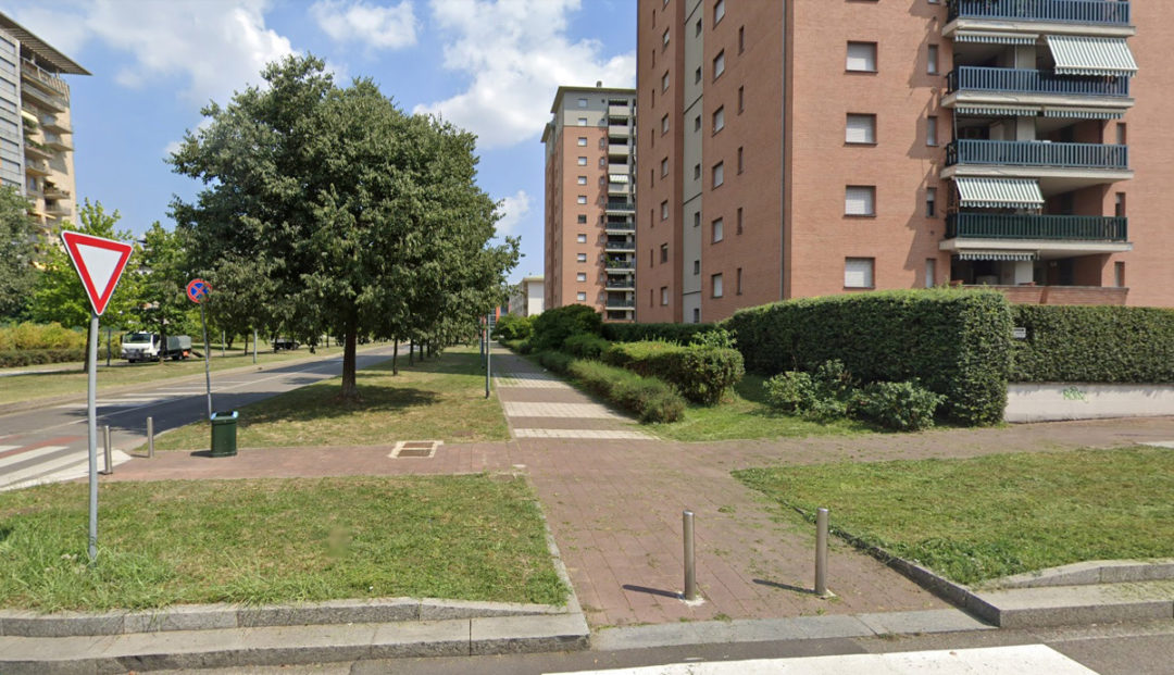
Via Spadolini (Google Street View). 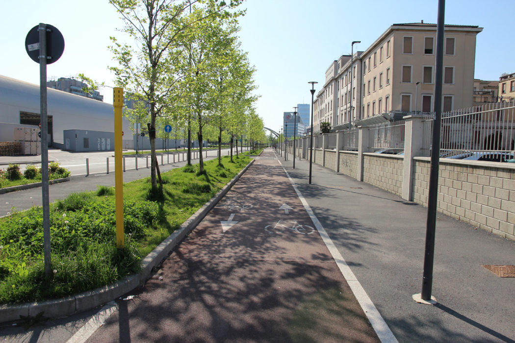
Via Don Luigi Palazzolo (foto BG/Sport&Impianti).


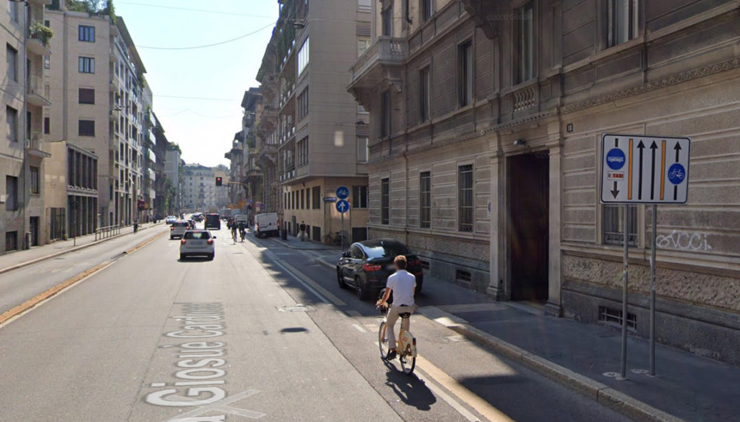
In the gallery, different types of bike lanes: in a roadway delimited with signs; in a mixed seat with pedestrians; in its own seat.
The dataset of the Municipality of Milan, which can be consulted online, updated to August 28, shows almost 300 km of bike paths: the total, however, is obtained by adding 3,550 individual sections, each of which is sometimes only three or four meters long… In total, 102.8 km are paths in their own right, 71.6 delimited with signs, 69.7 promiscuous with pedestrians and 55.1 promiscuous with vehicles. Few of the tracks in their own right are more than 400 meters long; the case of Viale Monte Rosa is exemplary, with 2.4 km of track divided into 59 sections.

Dataset delle piste ciclabili aggiornato al 28 agosto 2021 (Comune di Milano).
The difficulty in implementing an organic plan has not, however, prevented the boom in cycling, both as a private means of transport and as sharing: the sharing service managed by the City (BikeMi) offers 15,400 bicycles, of which 3,500 are pedal-assisted, alongside the private “free-flow” services RideMovi and Lime.